

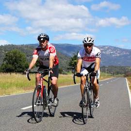
 Moyhu
Ryan’s Creek Figure 8
Moyhu
Overview
• Start at the Moyhu Park and take the Glenrowan-Moyhu Road.
• Take a left turn at the fork, 4km's down the road. Follow this road and turn left onto Wangaratta-Kilfeera Road (11 km's).
• Pass Greta South Primary School on the right. The road goes up, then down. On the descent go straight through the intersection and take the left fork into Kilfeera Road.
• Continue on for about 12km's and turn right into Upper Lurg Road.
• Follow this back to Upper Ryan's Creek and take the right fork down Benalla-Whitfield Road to Myrrhee.
• From Myrrhee take the Boggy Creek Road for 17km's until you get to C521 (Wangaratta-Whitfield Road).
• Turn left and return to Moyhu.
More like this
Explore similar things in the High Country Explorer.
- Cycling Cycling Route